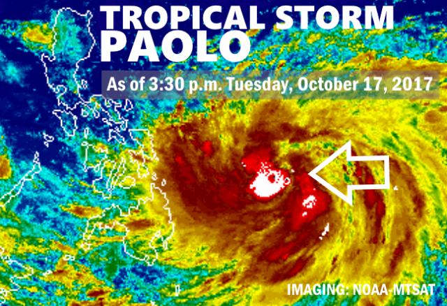
MANILA – Tropical Cyclone Paolo has intensified into a severe tropical storm as it continues to move over the Philippine Sea, east of the archipelago, the state weather bureau said Tuesday.
In its 11 a.m. weather bulletin Tuesday, the Philippine Atmospheric, Geophysical and Astronomical Services Administration (PAGASA) said “Paolo” was last spotted at 765 km. east of Guiuan, Eastern Samar, packing maximum sustained winds of up to 90 kph near the center and gustiness of up to 115 kph.
Moving north-northwest at a speed of 7 kph, “Paolo” is expected to intensify into a typhoon within the next one to two days.
The storm’s outer rain bands may bring scattered light to moderate with possible occasional heavy rains over the Bicol region, Visayas and Mindanao.
“Paolo” is forecast to be at 760 kph east of Borongan, Eastern Samar on Wednesday morning and at 1,075 km. east of Baler, Aurora on Thursday morning. It is expected to leave the country on Sunday.
No tropical cyclone warning signal has been raised.
Meanwhile, the low-pressure area (LPA) spotted 395 km. west of Coron, Palawan will bring scattered light to moderate with possible occasional heavy rains over Palawan.


