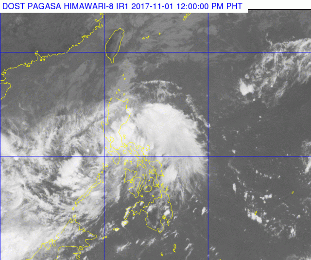
MANILA, Philippines — (UPDATE – 12:51 p.m.) Tropical cyclone warning signal No. 1 remains hoisted over northern Palawan including the Calamian Islands, Aklan and Antique provinces as the low pressure area south-southwest of Masbate developed into tropical depression “Ramil” Wednesday morning, November 1.
This means areas under the warning signal can expect winds of 30 to 60 kilometers per hour in 36 hours.
Late Wednesay morning, Ramil was last tracked 85 kilometers east-southeast west of Coron, Palawan with maximum sustained winds of 45 kilometers per hour near the center with gusts of up to 70 kph as it moved west at 20 kph, closing in on the Calamian group.
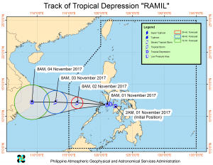
With estimated rainfall expected to be moderate to occasionally heavy within Ramil’s 200-kilometer diameter the Philippine Atmospheric, Geophysical and Astronomical Services Administration warned of widespread rains and thunderstorms that could trigger flashfloods and landslides throughout most of the country.
These areas are Central Luzon, Metro Manila, Bicol, Calabarzon, the Visayas, Zamboanga Peninsula, Northern Mindanao and Caraga, and the provinces of Marinduque, Mindoro, Romblon and the rest of Palawa.
The northeast monsoon, or “amihan,” will also bring rains to the rest of Luzon while localized thunderstorms could dump heavy rains in other areas of Mindanao.
Pagasa said sea travel will be risky over the seaboards of Northern Luzon and the eastern seaboard of Central and Southern Luzon.
Thursday morning, Pagasa said Ramil should be 425 km west of Coron.

