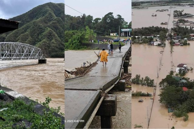
Bridges in northern Luzon were destroyed after Typhoon “Egay” (international name: Doksuri) ravaged the area.
These are among the main bridges in La Union, Ilocos Sur, and Cagayan, three of the provinces that received a heavy battering from the typhoon.
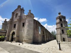
Quirino Bridge in Ilocos Sur
Some Filipinos spotted the century-old Quirino Bridge, which was formerly the Banaoang Bridge, partially submerged in floodwaters during the onslaught of “Egay.”
The bridge is considered one of the most beautiful bridges in the Philippines. It connects two mountains across Abra River.
“Egay,” however, did not spare this iconic infrastructure.
On Thursday morning, Facebook users uploaded photos that showed the main bridge between the two arches completely submerged in floodwaters.
The Provincial Tourism and Development Office also confirmed that parts of the bridge were swept away by Abra River’s current.
“Unfortunately, due to the high water elevation and strong river current caused by the continuous heavy rain of Typhoon #EgayPH, two spans of the bridge, which included the Light Show equipment attached to it, were swept away on Thursday morning,” the report reads.
Suguidan Bridge in La Union
On July 26, residents of Naguilian in La Union saw the near collapse of a bridge in their municipality amid the torrential rains and strong winds of “Egay.”
The provincial government later informed the residents about the situation on its Facebook account.
It also uploaded pictures that showed the havoc that had fallen on the Suguidan Bridge.
“Due to the onslaught of Typhoon Egay, Suguidan Bridge is temporarily closed until further notice. Vehicles may still travel to Barangays Ambaracao Norte, Suguidan Norte, and Suguidan Sur via Guesset Bridge,” the municipality of Naguilian said in its post.
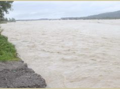
A part of the Manila North Road
The MacArthur Highway, also known as the Manila North Road, is a national highway in Luzon that connects Caloocan in Metro Manila to Aparri in Cagayan.
“Egay” dumped rains that caused the Apayao-Cagayan River to rise and engulf large parts of the road traversing it.
The regional office of the Department of Public Works and Highways uploaded photos that showed the devastation. It also advised motorists to take alternative routes in the meantime.
“Pansamantalang hindi madadaanan ang Manila North Road sa Calog Sur, Abulug, Cagayan. Lubog pa rin kasi sa baha ang daan sanhi ng patuloy na pagtaas ng lebel ng tubig sa Apayao-Cagayan River,” DPWH said.
“Pinapayuhan ang lahat ng mga motorista na iwasan muna ang ruta. Manatiling updated sa lahat ng oras para maging ligtas. Stay safe, Cagayanos!” it added.
Footage of tragedies on the ground
Several Filipinos also uploaded videos and photos that showed how “Egay” ripped through their houses and other properties.
A video that was reported by The STAR showed powerful winds nearly sweeping away the large umbrellas covering the stalls in Dagupan, Pangasinan.
A public school in Mankayan, Benguet also uploaded snapshots of fallen trees, scatter litter, and other damage caused by “Egay.”
The National Disaster Risk Reduction and Management Council (NDRRMC) reported that 89,639 families across 11 regions were affected by the typhoon.
There are also 22 logged damage to infrastructures amounting to P1.7 million.


