


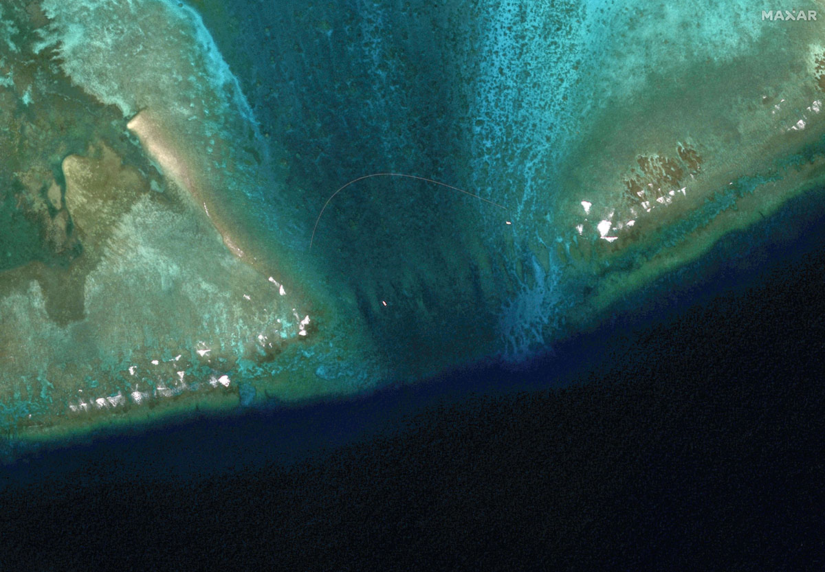
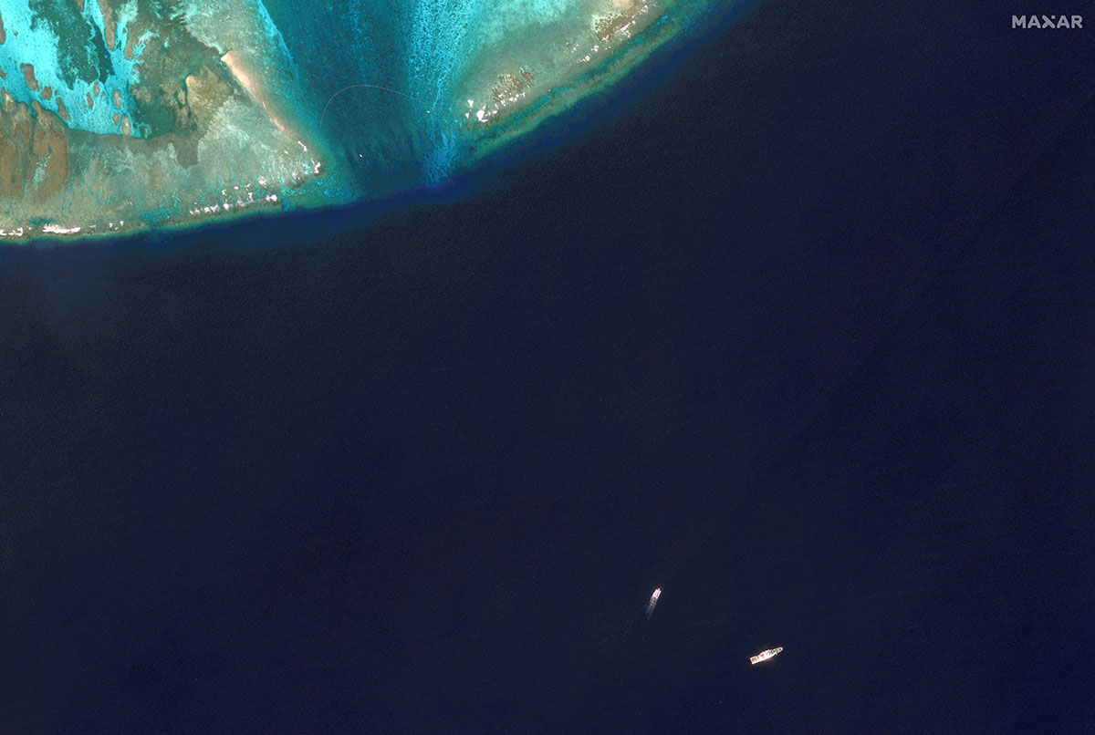
HONG KONG/MANILA — Satellite images of the hotly disputed Scarborough Shoal in the South China Sea show a new floating barrier across its entrance, near where Philippine ships and China coast guard vessels have had frequent run-ins.
One of the images taken by Maxar Technologies on February 22 and viewed by Reuters showed the barrier blocking the mouth of the shoal, where the Chinese coast guard last week claimed to have driven off a Philippine vessel “illegally intruding” into Beijing’s waters.
The Philippines, which last week deployed a Bureau of Fisheries and Aquatic Resources (BFAR) vessel to patrol the shoal and transport fuel to Filipino fishermen in the area, said that China’s claims were “inaccurate” and that Manila’s activities there were lawful.
China claims the Scarborough Shoal, although it is inside the Philippines’ 200-nautical mile exclusive economic zone. An international arbitration tribunal in the Hague said in 2016 that China’s claims had no legal basis — a decision Beijing has rejected.
That makes the atoll one of Asia’s most contested maritime features and a flashpoint for diplomatic flare-ups over sovereignty and fishing rights.
The satellite image bolsters a report and video distributed by the Philippine Coast Guard (PCG) on Sunday showing two Chinese coast guard inflatable boats deploying floating barriers at the shoal’s entrance on February 22.
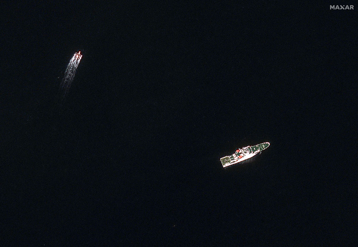
The PCG said that a China coast guard ship shadowed the BFAR vessel, “conducted blocking maneuvers” about 1.3 nautical miles (2.4 km) off the shoal, and closely approached it.
“We can assume that (the barrier) is intended for Philippine government vessels because they install it every time they monitor our presence within the BDM vicinity,” Jay Tarriela, a spokesperson at the Philippine Coast Guard said, referring to Bajo de Masinloc, Manila’s name for the shoal.
Chinese foreign ministry spokesperson Mao Ning said “Huangyan Dao”, China’s name for the shoal, was “China’s inherent territory”.
“Recently, the Philippine side has taken a series of actions to violate China’s sovereignty” in the shoal’s waters, she said. “China has to take necessary measures to firmly safeguard its territorial sovereignty and maritime rights and interests.”
Another satellite image showed what Maxar technologies described as “possible Chinese interception of a BFAR vessel” at Scarborough Shoal.
China claims almost the entire South China Sea, a conduit for more than $3 trillion in annual ship commerce. Its territorial claims overlap with those of the Philippines, Vietnam, Malaysia and Brunei.
“What we are seeing at the Scarborough Shoal now is likely the beginning of Beijing’s pushback against Manila’s pushback,” said Ian Storey, a senior fellow at Singapore’s ISEAS-Yusof Ishak Institute.
Since President Ferdinand Marcos Jr took office in June 2022, the Philippines has challenged China’s presence at Scarborough and its attempts to stop the resupply of Filipino troops stationed at Second Thomas Shoal, he said.
“China’s attempts to prevent Filipino fishermen from fishing at Scarborough Shoal is absolutely illegal,” Storey said. “The 2016 arbitral tribunal ruling gave fishermen from both countries the right to (fish there). Manila is merely supporting the legitimate rights of Filipino fishermen.”
The shoal is coveted for its bountiful fish stocks and a stunning turquoise lagoon that provides a safe haven for vessels during storms.
The Chinese removed the barrier a few hours after the BFAR vessel left, Tarriela said. It was not clear from the photos how robust the barrier was and whether it would have posed an obstacle to larger warships.
In an article on Sunday, state-media outlet Global Times said “the Philippines has abused and unilaterally sabotaged the foundation of Beijing’s goodwill to Manila” that allowed Philippine fishermen to operate nearby, by working against China’s sovereignty and jurisdiction.
“If such provocations persist, China could be forced to take more effective measures to control the situation,” the article said, citing experts.
— Reporting by Greg Torode in Hong Kong and Karen Lema in Manila; Additional reporting by Liz Lee in Beijing; Writing by Karen Lema. Editing by Gerry Doyle


