


Filipinos can now make informed choices on mobility after Google launched a tool that shows critical information about the infection trends of places in relation to the coronavirus disease.
The tech giant’s new initiative can be found on Google Maps, a web mapping service that offers satellite imagery, aerial photography, street maps, interactive panoramic views of streets and route planning, among others.
A user who wants to find out whether the place he or she will visit is a COVID-19 hotspot should open the app, tap the layers icon seen on the top right-hand corner and click the “See COVID-19 info” option.
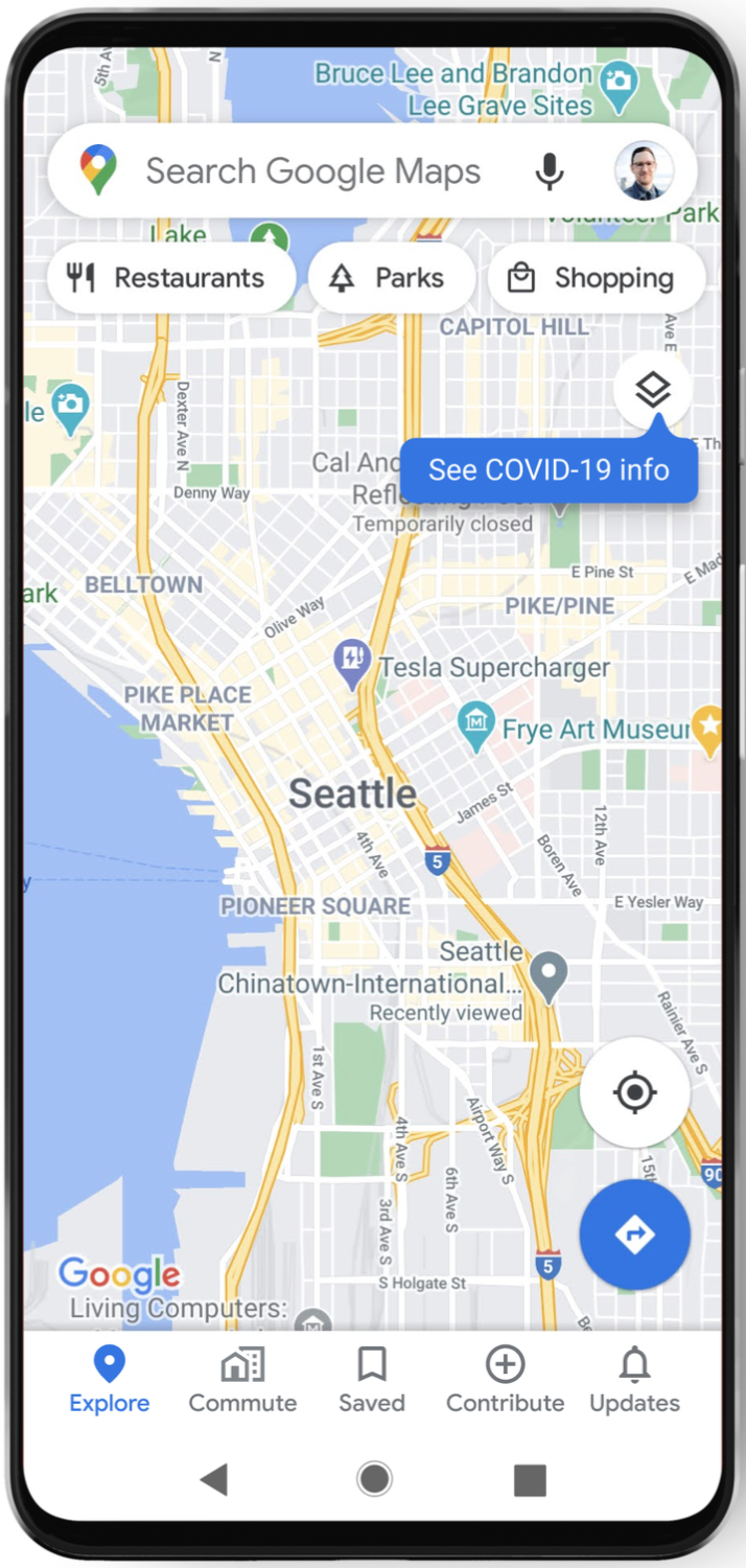
Clicking it will lead the individual to see an area’s seven-day average of new COVID-19 cases per 100,00 people, as well as a label that says whether the infection trend is increasing or decreasing through colors. These are the following:
- Grey: Less than 1 one case
- Yellow: 1-10 cases
- Orange: 10-20 cases
- Dark Orange: 20-30 cases
- Red: 30-40 cases
- Dark Red: 40+ cases
COVID-19 data are available at the country level for all 220 countries and territories that the app supports, including the Philippines.
Province and city-level data can also be viewed, if available.
The data are sourced from multiple authoritative sources which include Johns Hopkins and the New York Times.
Such sources get their data from the World Health Organization and government health departments, along with local health agencies and hospitals.
“Many of these sources already power COVID case information in Search, and we’re now expanding this data to Google Maps,” Sujoy Banerjee, Google Maps’ product manager, said in a blog.
“While getting around is more complicated these days, our hope is that these Google Maps features will help you get where you need to be as safely and efficiently as possible,” he added.
The tool has started to roll out worldwide in Android and iOS devices last week.
Google Map’s initiative comes while the Philippines’ National Capital Region is placed under the second least strict level of quarantine measure, the general community quarantine (GCQ), where more sectors and industries are open.
Public transportation is also allowed to operate in GCQ, albeit in a reduced capacity.
President Rodrigo Duterte extended the GCQ phase in Metro Manila on Monday. It will remain in effect until October 31.
READ: Duterte extends GCQ in Metro Manila until Oct 31
This decision came after local chief executives of Metro Manila sought for an extension of GCQ before they graduate to a more lenient quarantine measure, modified GCQ, which opens more sectors.


