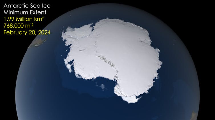
At the end of the southern summer, Antarctica’s sea ice hit its annual minimum. By at least one measure, which tracks the area of ocean that contains at least 15% of sea ice, it was a little above the record low of 2023.
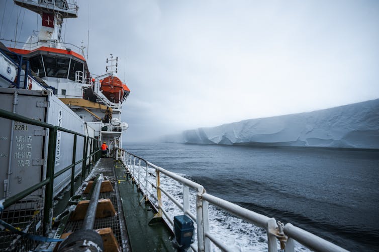
At the time, I was aboard the Italian icebreaker Laura Bassi, ironically surrounded by sea ice about 10km off Cape Hallett and unable to make our way to one of the expedition’s sampling sites.
Even just a decade ago, sea ice reliably rebuilt itself each winter. But something has changed in how the Southern Ocean works and the area covered by sea ice has decreased dramatically.
Our aim was to track the changes happening in the ocean around Antarctica and to make targeted measurements of some of the processes we think are responsible for this loss of sea ice. Most likely, this is a consequence of warming oceans and so we focused on identifying the pathways warmer seawater could find to drive more melting.
The southernmost shelf sea
The annual freeze-thaw cycle of Antarctic sea ice is one of the defining properties of our planet.
It affects the reflectivity of a vast area of the globe, oxygenates the deep ocean, provides habitat across the Southern Ocean food web and plays a role in the resilience of ice shelves.
The voyage was led by a team of scientists who coordinate Italy’s longstanding research in the Southern Ocean.
For decades, they have been maintaining instruments in the Ross Sea region and the data they have been collecting are now proving crucial as we seek to understand the implications of sea-ice changes in terms of physics and biogeochemistry.

Lana Young/AntNZ/NIWA/K872, CC BY-SA
The expedition sailed a two-month counter-clockwise loop of the continental shelf in the Ross Sea. Continental shelves are shallower and biologically very productive regions that surround all of Earth’s continents.
Continental shelf seas around Antarctica are special because of the presence of sea ice – but this varies in space and time.
The US National Snow and Ice Data Center has developed a visualisation tool to compare sea-ice conditions during different times.
It shows that by the end of summer, the Ross Sea region holds only a few patches of sea ice. And this year, the patches were even fewer than in the past.
The region is the southernmost open water on the planet and acts as a gateway to seawater flowing in and out under the largest (by area) ice shelf on the planet – the Ross Ice Shelf.
The sea ice we encountered came in a variety of thicknesses and snow cover. We could see that in some places, sea ice was present in densities less than a satellite could recognize, but possibly enough to have an influence on how the upper ocean exchanges heat with the atmosphere above.
The state of sea ice
This reinforced our understanding of the importance of the spatial variability of sea ice. Satellites show that most of the sea-ice coverage, at its minimum, was found in a big patch in East Antarctica, due south of Hobart, and the ice-choked Weddell Sea.
The Weddell Sea and its Filchner-Ronne Ice Shelf are the Ross Sea’s opposite. At the late-summer sea-ice minimum, the Ross Sea is largely free of ice, while the Weddell Sea stays filled with ice.
This was the pack-ice nightmare that trapped Shackleton’s Endurance over a century ago.

NASA, CC BY-SA
At a personal level, the sights during our expedition were a privilege. They took me beyond anything imagined from data and models. Giant icebergs became common place. Penguins, seals, skua and whales all passed by the ship at various times.
In the same way we send people into space, there are substantial benefits to having scientists on location developing their perspectives on the science. However, it is clear that Antarctic ocean data collection systems need to expand when and where they collect information.
The future is robotic
One feature of the voyage was the use of robots. We deployed 11 relatively simple Argo floats that will drift around the region for years, surfacing to send back data on temperature, salinity and in some cases oxygen.
We also sent three robotic ocean gliders on their data-collecting missions independent of the ship. This meant we could capture flow data in the long north-south troughs that are a feature of the region, while the ship was elsewhere.
We retrieved these robot gliders after several weeks, bringing back unique maps of changing ocean temperature and salinity. The data provide evidence of warmer water lying just beneath the edge of the continental shelf, highlighting the fragility of the system.
There is a growing sense that the Ross Sea sector will become more important in the coming decade. With substantial changes upstream in the Amundsen Sea, where glaciers are retreating at an accelerating rate, and the possibility for warmer water finding its way onto the continental shelf, there is the potential that the largest ice shelf on the planet might start to change.![]()
Craig Stevens, Professor in Ocean Physics, University of Auckland, Waipapa Taumata Rau. This article is republished from The Conversation under a Creative Commons license. Read the original article.


