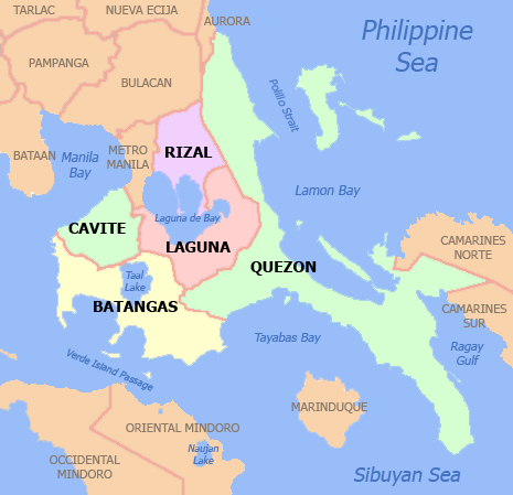
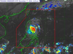
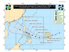
MANILA (UPDATE 3 – 3:01 P.M.) Gusty winds and moderate to heavy rains with thunderstorms will continue until Tuesday evening over Metro Manila, Central Luzon, CALABARZON, MIMAROPA, and Pangasinan due to tropical depression Maring, according to the Philippine Atmospheric Geophysical and Astronomical Administration (PAGASA).
In a press briefing, weather specialist Nikos Peñaranda said that as of 1 p.m., the cyclone sped through the vicinity of Tanay, Rizal then headed towards Bulacan and upper part of Manila Bay.
It has also retained its maximum winds of 60 kilometers per hour, its gustiness up to 100 kph, and its speed 15 kph.
Maring is expected to exit Luzon’s landmass via Zambales-Bataan by Tuesday evening, around 9 p.m. to 10 p.m.
Based on PAGASA forecast, the tropical depression will leave the Philippine Area of Responsibility on Thursday morning.
PAGASA also issued a Red Heavy Rainfall Warning in Metro Manila, Bulacan, Pampanga, Bataan, and Rizal. This meant serious flooding is expected in low-lying areas.
Meanwhile, flooding is feared, due to intense rains in Cavite, Laguna, and Batangas as PAGASA issued an Orange Heavy Rainfall Warning in these areas.
A Yellow Heavy Rainfall warning has been issued in Zambales and the province of Quezon. This meant heavy rains with possible flooding.
Areas still under storm signals
Meanwhile, a total 14 areas are still under Storm Signal No. 1:
Metro Manila
Cavite
Laguna
Batangas
Rizal
Camarines Norte
Northern Quezon including Polilio Island
Southern Aurora
Pampanga
Nueva Ecija
Tarlac
Zambales
Bataan
Pangasinan
Minimal impact from Lannie
Meanwhile, PAGASA announced that the other typhoon, #TalimPH (Lannie), will exert minimal effects as it heads toward Taiwan and Eastern China. It was last located 865 km east of Basco, Batanes.
Tropical depression #MaringPH ewas arlier expected to cross the vicinity of the National Capital Region sometime Tuesday afternoon after making landfall at Mauban, Quezon at 9 a.m., PAGASA said.
Tropical Cyclone Warning Signal #1 was placed Tuesday morning over Metro Manila, Bataan, Cavite, Batangas, Camarines Norte, Camarines Sur, Northern Quezon incl. Polillo island, Rizal, Bulacan, Pampanga, Nueva Ecija, Tarlac, Zambales, Pangasinan, Laguna, Southern Aurora.
Metro Manila, Central Luzon, CALABARZON, and MIMAROPA were expected to experience moderate to heavy rains with thunderstorm due to the tropical depression.
However, PAGASA said rains are expected to subside in Metro Manila despite being on the cyclone’s path as the region has already reached its peak rainfall amount early Tuesday morning.
As of 10 a.m., the cyclone was located in Laguna with sustained winds of 60 kilometers per hour and a gusts up to 100 kph.
It was tracking north-northwest at 15 kph.
This was the situation in San Pedro, Laguna:
Look: mistulang ilog na ang national highway sa san pedro laguna pic.twitter.com/B23qZL0xOy
— GARY D.?? (@GarryDeLeon) September 12, 2017
In Manila, enterprising residents made the most of the situation.
WATCH: Para sa grupong ito, may kita sa baha sa Maynila. pic.twitter.com/WN2SlC0qnu
— JV Lim Arcena (@jv_arcena) September 12, 2017
Cavite, Laguna, and Batangas continued experiencing heavy rains and possible flash floods.
PAGASA also said heavy rains would remain concentrated in Central Luzon and Southern Luzon based on their 24-hour rainfall forecast.
Forced evacuation
Forced evacuation was resorted to in the towns of Atimonan in Quezon and Calamba, Laguna, where 13 people were reported missing, radio reports said.
PAGASA’s weather division chief Robert Sawi said in a radio interview the cyclone was just 35 kilometers away from the Aurora-Quezon area, moving north-northwest with a speed of 15 kilometers per hour.
The cyclone is also expected to leave the Philippine Area of Responsibility Wednesday morning.
PAGASA hydrologist Elmer Caringal said that, based on Maring’s track, the weather disturbance could affect Angat, Ipo, La Mesa, and Pantabangan Dams.
Based on 6:00 a.m. figures, Angat Dam had an elevation of 192.88 meters, compared to its normal height of 210 meters.
Ipo was at 101.4 meters – a little higher than its normal elevation of 101 meters. If the rains continue unabated, water would have to be released (“magbabawas”) at some point, Caringal said.
La Mesa had an elevation of 79.52 meters – close to its normal height of 80.15 meters. Once the water level has reached that, it would overflow into the Tullahan River.
Meanwhile, Pantabangan was at 190.5 meters – still far from its normal height. of 216 meters. There has to be an additional 1.904 average meters of rainfall around the watershed before overflow condition is reached, Caringal said, which means that PAGASA doesn’t expect water to be released any time soon.
Caringal noted that they had been monitoring Magat Dam, which was at 187.48 meters – only a small deviation from its normal height of 190 meters. Because of Maring’s track, however, there was only a “very small chance” that the dam would be affected, and only a “very small chance” that it would have to release water.
PAGASA also issued flood bulletins for the Bicol River Basin and Pampanga River Basin.
As for the Pasig-Marikina River Basin, Caringal said they had sounded the alarm at their warning posts around Montalban, San Mateo, Sto. Niño, Tumana, and Marcos Highway to alert residents of the rising water levels.


