MANILA, Philippines — Scattered rains and thunderstorms will be the norm throughout the country on Tuesday due to the effects of a low pressure area, the tail-end of a cold front and the northeast monsoon, or “amihan.”
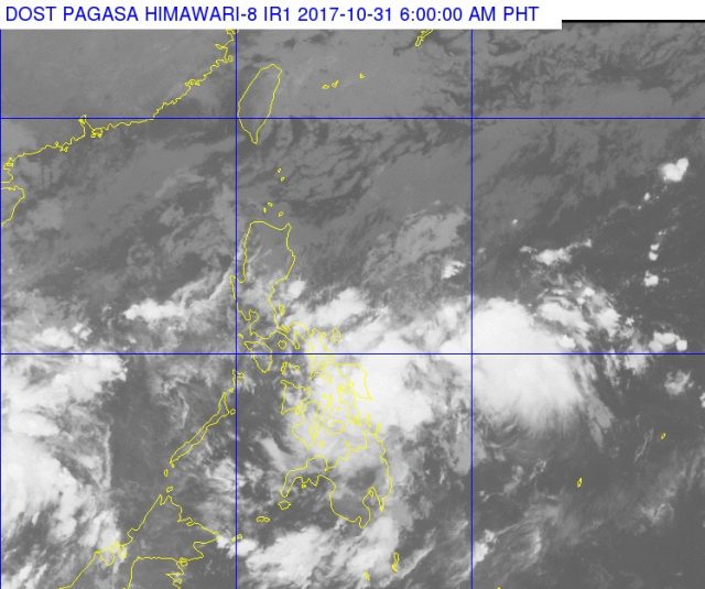
The Philippine Atmospheric, Geophysical and Astronomical Services Administration last tracked the LPA at 125 kilometers east of Surigao City early Tuesday morning.
This weather system will bring cloudy skies to the Visayas, and to the Mimaropa, Bicol, Caraga, Davao, Northern Mindanao and part of the Calabarzo regions. Pagasa warned of “possible lightning and light to moderate with occasional heavy rains which may cause flooding/landslides.”
Localized thunderstorms will be felt in the rest of Mindanao.
The tail-end of the cold front will bring cloudy skies with scatted rains and thunderstorms to Aurora, Quirino and Quezon provinces. Pagasa alerted residents of these provinces to possible floods and landslides.
The amihan, on the other hand, is forecast to bring cloudy skies and rains to Metro Manila, Central Luzon, the Ilocos region and part of Cagayan Valley.
Waters around Luzon, Visayas and the eastern section of Mindanano are forecast to be moderate to rough, and slight to moderate off the rest of Mindanao.


