


There is no truth that the Philippines will experience an “equinox phenomenon in the next five days” which would supposedly make temperatures rise as high as 40 degrees Celsius.
On Thursday, state weather bureau PAGASA, or the Philippine Atmospheric, Geophysical and Astronomical Services, debunked viral claims that an “equinox phenomenon” would happen and that people should “stay indoors especially from 12pm-3pm daily.”
A false message circulated on social media and on messaging platforms which implied that a “heat wave” will occur in view of the supposed equinox phenomenon.
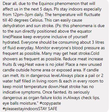
“WALANG KATOTOHANAN na magkakaroon ng ‘equinox phenomenon’ sa susunod na limang araw sapagkat tapos na ang spring equinox noong 20 Marso. Ang autumnal equinox naman ay mangyayari sa 23 Setyembre pa,” the agency said on Facebook.
In the same post, the weather bureau also shared infographics about equinoxes and heat wave, temperature increase and tips on what to do during the dry season.
Marami ang nagpapakalat ng mensaheng ito sa Facebook, Twitter, at maging sa Viber. WALANG KATOTOHANAN na magkakaroon…
Posted by Dost_pagasa on Wednesday, May 6, 2020
On equinoxes
There are only two equinoxes that the earth experience, according to PAGASA. These are the spring equinox that marks the beginning of longer days and shorter nights in the country.
An autumn equinox, meanwhile, is the start of longer nights and shorter days.
An equinox happens when the solar terminator, otherwise known as the dividing line separating the light and dark parts of the planet, becomes perpendicular to the equator.
This results in a nearly equal length of day and night all over the planet, where there are 12 hours of daylight and 12 hours of darkness.
Is there a heat wave in the country?
The viral message also claimed that there will be a “heat wave” in the supposed “next five days” but PAGASA said that the country is not yet experiencing the phenomenon despite the rising temperatures.
Citing the World Meteorological Organization, the weather agency stated that a heat wave is a period during which the maximum temperature recorded in five consecutive days exceeds the average maximum temperature by five degrees Celsius.
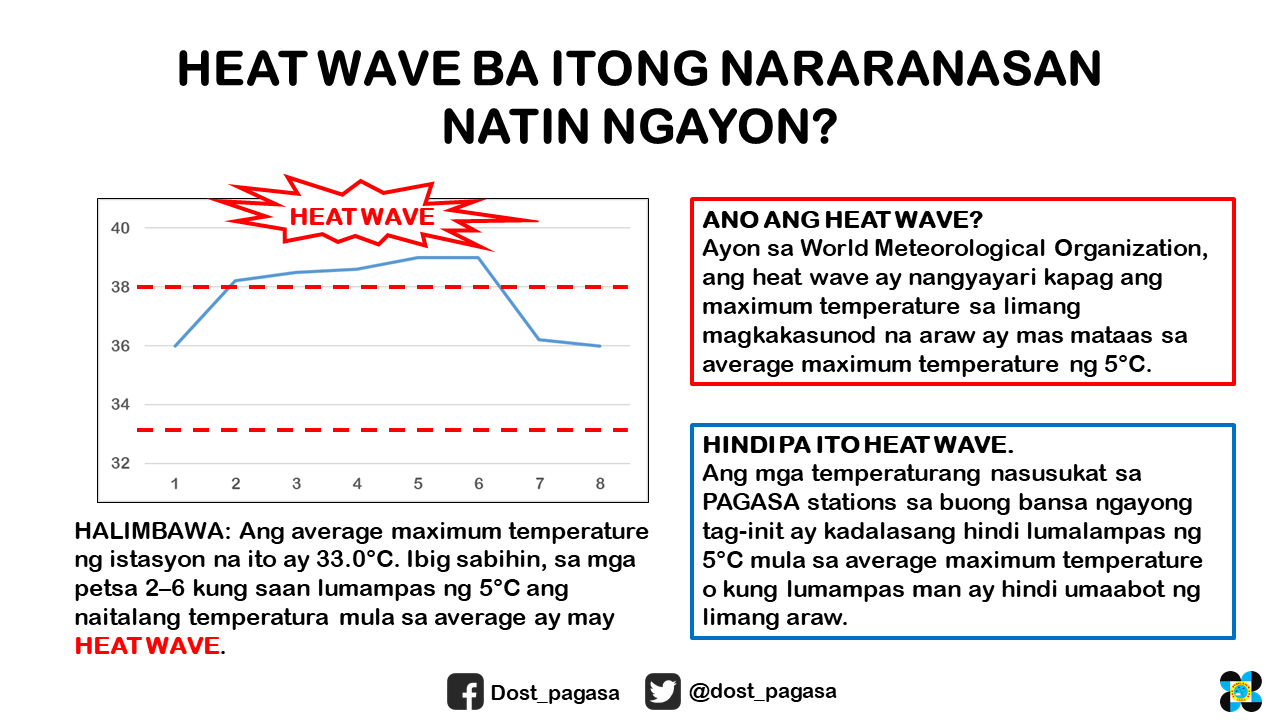
“Halimbawa: Ang average maximum temperature ng istasyon na ito ay 33 degrees Celsius. Ibig sabihin, sa mga petsa na 2-6 kung saan lumampas ng 5 degrees Celsius ang naitalang temperatura mula sa average ay may heat wave,” it said, referring to its Quezon City station.
The agency said that the Philippines is not yet experiencing a heat wave since its monitoring stations located across the country has not yet recorded a temperature that exceeds five degrees Celsius from the recorded average maximum temperature.
Why is it so hot nowadays?
PAGASA explained that the Philippines is experiencing a dry season that started in March and will last until May or the first week of June.
“Maiinit at maalinsangan ang panahon sa atin tuwing tag-init dahil sa Ridge ng High Pressure Area (HPA) at Easterlies,” it said.
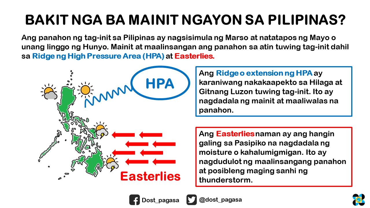
The agency through Panahon TV stated that “ridge” refers “to the extended part of an HPA or an anticyclone.”
“Unlike a Low Pressure Area, this indicates an area where the atmospheric pressure is higher than its surroundings. Formation of clouds is usually suppressed, thus, less chance of rains,” the program said.
The agency shared that the ridge or extension of the high pressure area usually affects Northern and Central Luzon during the dry season, which results in hot weather conditions.
Easterlies, meanwhile, refer to the warm winds coming from the Pacific Ocean which could bring hot and humid weather that may cause localized thunderstorms.


